Tuesday, August 12, 2008

“Nautical Ladder”

The “Nautical Ladder” development at Santa Rosaliita, or
How to divide a town, step by step.


A study done by Algalita Marine Reseach Foundation, the Autonomous University of Baja California and CISESE, (a Mexican Gov’t. Research Institution) prior to the proposed development of a “Port of Refuge” on Baja California’s pacific coast which would also have the capacity to trailer boats from the Pacific to the Sea of Cortez, showed the coastal environment of Santa Rosaliita to be in a pristine, unaltered condition. The small fishing village there was having no measurable effect on the local marine environment. The location chosen for the nautical ladder development promulgated by President Fox was in the middle of a sandy beach, with sand dunes upwind. The fishing village was mostly to the southeast, and a well-known windsurfing site was to the northwest.

From a coastal engineers standpoint, the area selected was in the middle of a “littoral cell,” which is an area where sand is transported along a coastline. It has come to be known that jetties built out from littoral cells accumulate sand up-current, and erode sand down-current from the jetty. The town was down-current. One of the early settlers of the town, whose property was on the east side, is rumored to have enticed his brother, under the influence of alcohol, to sign over title to his land on the west side and then this individual, with enough land to accommodate the highway and marina, ceded his land to the government for the marina development in exchange for money and rights to concessions at the new facility. He also built himself a large home at the top of the hill behind the town overlooking the marina. Advice from several quarters to put the marina at the southeastern end of the town, where the sand beach changed to rocky coastline went unheeded, and the jetties for the small harbor were built, right in the middle of a windswept, blowing sand beach. The results as monitored by Dr. Azdrubal Martinez of UABC for AMRF were predictable: 1) A gradual lessening of the slope of the beach with sand deposition seaward of the jetty, 2) A steepening of the beach with erosion in front of the town, and 3) Constant filling of the interior of the marina with sand, both blown by the wind and washed in by the sea.

Currently, the small warehouse where the artisanal fishery loads its catch into a refrigerated truck, is inundated with water during winter storms, and one of the houses built near the coast has lost a fence and a bathroom. The individual who ceded land for the marina began to make representations to government officials that he was the owner of the whole town. He was advised by his attorneys to pretend he didn’t know anybody in the town, presumably to add credibility to his claim that they were not original inhabitants. FONATUR, the government tourism agency, claimed they bought the whole town from this individual. To assert their claim, they began by bulldozing the soccer field and were preparing to do the same to the cemetery in order to build a hotel. The meager income of the fishermen had to be used to buy gasoline to drive to the government seat in San Quintin every 15 days to sign papers to gain rights to their property. When FONATUR was frustrated in their attempt to take the whole town, they decided to take the back part and put up a fence. Four village people went to jail for tearing down the fence, but actually the whole town participated. Their fine was set at $700/each but was reduced to $500 because that is all the money the townspeople had when they went to bail them out.

Since the standoff, the marina infrastructure has been completed, but sits idle. Two large Pemex fuel tanks are on the dock and a travel lift is ready to lift vessels up to a 22 foot beam for trailering to Los Angeles Bay on the gulf side of the peninsula. This presents a tragi-comic scene in a marina which is filled with sand, and where there is water, the average depth is about 2 feet. One improvement that the townspeople seem happy with is the arrival of electricity. Two months ago, the installation was complete with telephone poles, and every two months someone comes to read the electric meter in front of each house. The fishermen still use their solar panels to charge batteries and provide electricity like before during the frequent power outages on the new line.

Today, Santa Rosaliita is a town split in two. The family of the turncoat is isolated in their hilltop home and charge $5 a night for campers to camp at the windsurfing spot northwest of town. Members of the family on the hill do not enter the main town, nor do their children play with the children in town. They have a fine view of the bay, and the marina they helped create which will never service a vessel until major changes are made. The interior will have to be dredged almost continuously, as every day winds blow in large quantities of sand and currents bring sand in from upstream. The sand has made a ramp for itself over the jetty rocks, further facilitating its entry into the marina.
Capt. Moore


We spent a great deal of the day while in the town of Santa Rosaliita walking around talking with people and trying to better understand the scale of the changes already occuring to the beach and the town as well as how this place will change in the seasons and years to come. This harbor has only been in place for a few years now and already there is sand out to the end of the jetty on the windward side. The sand slopes up to the tops of the rocks covering them almost completely in spots, the new berm acts like a ramp for blowing sand which comes over it at an incredible rate even on a calm day depositing into the harbor on the other side. I can’t imagine this place ever being usable, much less profitable since the only way anyone will ever get to use the boat ramp and hoist will be to install a permanent dredge on sight.

Good photos of the calamity were a big part of the reason we made the trip, and I took lots of them.

Since we are saving bandwidth and emailing material in a semi-finished form to our friend Tim at Seanet Electronics in San Diego I’m captioning the photos by file name all in one place.
Jeff Ernst


The gas dock at Santa Rosaliita and the piers for the boat hoist.


The beach where our dingy is tied up was designed to accomidate easily a 50 foot power boat. The pier on the lefthand side is the outside pier of the 23 foot beam vertical hoist.


The new house of the man who no one talks to anymore, on his scenic hillside overlooking the unfinnished harbor.


The new road isnt safe from the shifting sand either, and in the calmest season it is still covered in sand in several spots.


The same guy that claimed to own the town and sold it to the govornment tries to charge people 5 dollars a night to camp on the newly improved beach above to the town and the harbor.


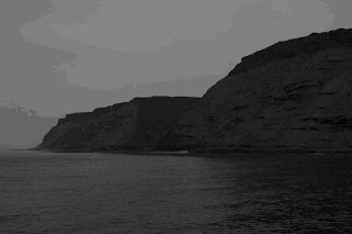
The town and harbor of Santa Rosaliita, note the breakwall which now has beach extending the length of what was a jetty sticking out perpendicularly to the shoreline.


The new beach


The next generation of Santa Rosaliita residence.


Checking the meter; the town of Santa Rosaliita got hooked into the power grid 2 months ago.

Saturday, August 9, 2008

Sampling at Cape Colnett


Cabo Colnett at sunset


We departed Wednesday night around 11pm from Marina Coral in Ensenada, heading south to Cabo Colnett. We were helping provide a marine biologist at the local university with bottom grab samples to help characterize the benthic invertebrate species within the several mile wide relatively shallow bay. Some of the samples we took were also set aside to be processed for POPs (persistent organic pollutants) and heavy metals. The combination gives researchers data with which to compare future samples using polychaete worms, and the sediments themselves as current baselines for the health of the bay and how human development; locally or in the heavy population centers not too far north, might be impacting the area. Until recently nobody had bothered with the expense of detailed marine monitoring in this area. With rather limited funding environmental monitoring programs in Baja need to pick and choose carefully, and; looking at the place in its current form, its clear why this wouldn’t be high on the list.
Backed against a crumbling cliff to the North and a small fishing village and surf spot to the South, Cabo Colnett supports an abundance of life and natural resources. However, development here looks much like it must have 100 years ago, a small collection of boats and shacks in various states of disrepair sit at the base of the cliff, no boat ramp to speak of, but a gentile gravel beach and a natural channel between the kelp forests to each side make for a natural substitute. There is ranch and farmland in the low valley further along the coastline, with a couple of houses here and there. There are no paved roads to anywhere within sight of the coast here and the fleet of open fishing boats that fish and dive the kelp paddies numbered less than a dozen on the day of our sampling trip. The small settlement to the south, Punta San Telmo had a launch ramp a church and a modest collection of old homes, which I presume are occupied almost entirely by the men we saw fishing and their families. There is also a surf camp for the “Cuatro Casas” surf break.
-Jeff Ernst
The peninsula known as Baja (Lower) California is undergoing uncontrolled, explosive development of its pristine coastline, largely as a result of its neighbor, Alta (Upper) California’s need to create infrastructure for its goods. Alta California refuses to allow these industrial developments on its own soil, because of the environmental and human health costs. Sempra Energy has built the first Liquid Natural Gas port facility at a beautiful headland known as Salsipuedes, in contravention of the Local Coastal Plan, which called for the area to be preserved as open space and natural habitat. It did this through heavy-handed political bribery. The gas will come by pipeline to the US and very little will be used in Mexico. The bay of Salsipuedes is the home of an aquaculture facility. In order to cool the LNG for shipment, 50 thousand cubic meters of seawater per hour will have chlorine added to it at the rate of 50 kg/hr. This water will then be pumped out into Salsipuedes bay after its temperature has been raised 7 degrees C. It is doubtful that the aquaculture operation, let alone the kelp forest and its creatures, can survive this relentless insult, day in day, out, year after year.
A second development, the mega-port of Cape Colnett, is currently being planned to take cargo which would have gone to LA/Long Beach, had the citizens of LA County not rebelled at the health and quality of life costs of expanding their ports to accommodate the goods of globalization (95% of all manufactured goods are transported by ships). This port will have the longest breakwater ever built, 8 kilometers, and enclose a huge bay, which currently has a great surfbreak (cuatro casas), an enormous kelp forest and a sustainable fishery. The point itself at Cape Colnett is reminiscent of Dana Point before development.
We just finished sampling 20 stations for bottom dwelling (benthic) organisms to get baseline data on what may be changed forever if the development goes through like Sempra’s did. There are three main reasons the project doesn’t make economic sense. First, the goods will go by a new rail line to the United States near the border of California and Arizona. Their final destination will be the Central and Eastern US, however. Second, the Arctic ice cap is melting and the Northwest Passage will be a reality for ships from Asia to reach the East Coast. Thirdly, the port will take jobs away from port workers in LA/Long Beach, since labor costs will be less in Mexico, and environmental protections will be less as well, lowering costs for shippers.
-Cpt Charles Moore
I’m including three other photographs although they are a bit lower quality than the last several posts because I have to use the satellite connection. We just dropped anchor off San Quintin and are planning to spend the night here heading out early tomorrow to keep making time south.


1: a sandstone cliff butted up right against the shore and a thick line of kelp


2: the only visitors to the beach that day


3: fishing the old fashioned way


Wednesday, August 6, 2008


Pt San Miguel


So we just got out of the water after motoring over pre dawn to surf point san miguel at first light. Decent waves and completely to ourselves both Charlie and myself got some good rides and some nice hollow little chest high tubes. Im posting up a picture of the surf break but it was take after we got out and the tide came up too much for how small a swell it is to really show anything impressive.

The other pictures are of a Great Blue Heron Ardea herodias, that used our front railing for a rest stop yesterday evening while we were tied up in port at Marina Coral. It was gracious enough to sit around while i took its picture a few times and since we still have high speed internet im posting the three best ones

enjoy


We depart this evening for Cabo Colnett, the area of of interest for our Mexican colleges where we will be preforming bottom grabs in hopes of using polycheate worms in the sediments as an indicator species, showing changes in the levels of toxins (pop,s heavy metals etc) in the area prior to a possible major development project.

More on this later, as work begins.

-Jeff

Monday, August 4, 2008

Blue Whales and Todos Santos


Yesterday we took the Alguita on a short hop across the water to Todos Santos Island, home to the infamous Killers, the aptly named stand out surf spot that took the biggest winter wave contest some years back, and now beacons big wave surfers from around the world with 60 foot faces on the big winter swells.
Algalita and the Alguita have been involved with the kelp forest habitat out on these islands since joint monitoring began in the early 1990s. In conjunction with a then student of the University of Baja Califronia at Ensenada Lydia Ladah, we have helped improve kelp habitat at that site; and in the 15 years or so since monitoring began the kelp beds off, the lighthouse island are healthy and alive, teaming with all sorts of organisms. We were just observing this trip checking on one of the organizations longest projects while we were in the area.
The visibility wasn't great and the water was pretty chilly if you got more than 10 feet below the surface, so we spent most of our time exploring the upper canopy and checking out the smallest of the two islands on foot, and of coarse fishing


The trip back from Todos Santos was the really exciting part of the day t, we came across a group of Blue Whales, which moved in a giant slow circle coming up to breath leisurely and often almost without exception as a pair. Today we found out they have been just hanging out in the bay where we saw them since April. Blue Whale travel habits are rather poorly understood but the cold, deep nutrient rich waters coming out the very canyon that makes this place such a stand out surf spot, must provide good feeding grounds for a pair of whales in the know.


Todos Santos seen on the trip out from Ensenada yesterday morning


The scariest break on the island Thor's Hammer on a small day it still pitches into the rocks with some force. Pelicans cruising overhead in formation


whales whales and more whales! can you guess who got a new telephoto lens?


More cool stuff when it comes up,

-Jeff

Back in Mexico!

I'msitting around digesting lunch on a sunny monday afternoon in Ensenada, the boat is on its first major trip since our stint in drydock, and most of the items on the fix-it list are done. Currently we are using the internet connection at the Marina Coral Hotel in Ensenada so here are some high res photos cronicaling our adventure from Long Beach to San Diego to Todos Santos to here. After Wednesday we will be using the satellite connection to upload images which requires us to be a bit more frugal, so enjoy.


Point Loma in the mid afternoon of Friday the 1st, as we depart San Diego, not much in the way of good sailing wind but we managed to motor sail most of the way to the Coronado's for a quick snorkel dive and some bird watching.


Middle Rock at the Coronado Islands, a series of fairly small and uninhabited Islands belonging to Mexico that actually lie just north of the border off San Diego. This little white washed island represents the furthest known breeding location for Brown Boobies that we know of. It also attracts all sorts of other birds which are rarely seen that far north anywhere else.


Shown in the first picture is; to the best of my investigating, a Brown morph of a Red Footed Boobie Sula sula along with a Blue Footed Boobie Sula nebouxii with a Brandt's Cormorant Phalacrocorax penicillatus in the background.

Picture two is a Blue Footed Boobie handing out on a rock.

Picture three is Boobie right after takeoff.

Picture four is a a rock covered in... Cormorants.


Im still behind by one day worth of cool stuff and good photos, more comming.
Stay tuned,

-Jeff